Wednesday, July 31, 2013

Cory Pass & Edith Pass

Trip Date: July 2009


The thing that intrigued Jaryd and I about this day-trip was the fact that various guide books described the hike as, "one of the most difficult hikes in Banff National Park."  We both seemed up for the challenge!  It is a 12.9km loop over both Cory Pass and Edith Pass with an elevation gain of almost 1,000m, most of which is gained during the hikes first 4.5km!  It was definitely a leg burner, to say the least, but one that was well worth it.  The trailhead for this hike is the Fireside Picnic Area, which is about 135km west of Calgary along the Bow Valley Parkway (Highway 1A).  

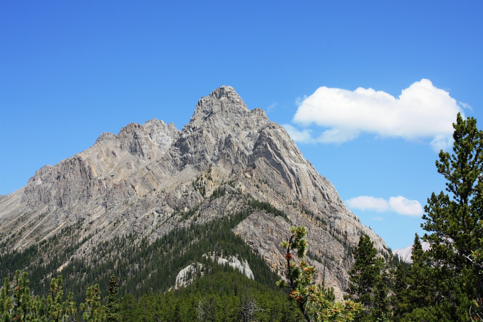
Mt. Edith
Mt. Cory and Mt. Edith with Cory Pass connecting the two mountains
Me trying to comprehend how I'm going to get all the way up there!
We made it!  The view from Cory Pass.
Mt. Edith.  If you look closely you can see the trail we used.
At the summit of Cory Pass (2,350m) is the entrance to the aptly named Gargoyle Valley.  The "gargoyles" are unique rock formations that appear to be guarding the entrance to the valley beyond.  They are pretty neat to see up close and make for excellent photography subjects.  

The entrance to Gargoyle Valley
"Gargoyle" rock formations
Standing guard over the valley
More gargoyles and a cave on Mt. Cory
Walking through Gargoyle Valley
Jaryd standing on a gargoyle with Mt. Louis in the background
Sitting on a gargoyle
Mt. Louis is sometimes referred to as Dogtooth Mountain and it's easy to see why
The east side of Mt. Edith as we approach Edith Pass and then our descent back to the truck

Plain of Six Glaciers & Lake Agnes

Trip Date: June 2009


Today's adventure was one of Banff National Park's classic hikes; Plain of Six Glaciers with a return trip via Lake Agnes.  Lake Louise is approximately 185km west of Calgary along the Trans-Canada Highway and would be kick-off point for the hike.  The day was a 13.7km round-trip hike with elevation gains of 365m to the Plain of Six Glaciers Tea House and an additional 385m to the Lake Agnes Tea House.  The trail started at Château Lake Louise right on the lake's shoreline.  It was about 5.3km to the Plain of Six Glaciers Tea House, then another 4.9km up to the Lake Agnes Tea House, and finally 3.5km back to Château Louise where we started.  We couldn't have gotten better weather for the day's outing.  Another great day to be outside!

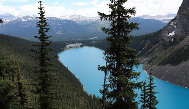
Lake Louise, one of the most photographed lakes in the world, is named after Princess Louise Caroline Alberta (1848-1939), the fourth daughter of Queen Victoria and the wife of the Marquess of Lourne, who was the Governor General of Canada between 1878 and 1883.  The lake's emerald colour comes from rock flour that's carried into the lake by melt-water from the surrounding glaciers overlooking the lake.  

Lake Louise
The Big Beehive as seen from the lake shore
The Lakeshore trail on our way to Plain of Six Glaciers trail
The lake shore is also home to Fairmont's Château Lake Louise, one of Canada's grand railway hotels.  It sits on the eastern shore or the lake and was built at the end of the 19th and the beginning of the 20th century by the Canadian Pacific Railway (CPR).  

Château Lake Louise
Mt. Aberdeen and Mt. Lefroy
Christine and I above Lake Louise
Jeff and Sarah
Mt. Lefroy and Mt. Victoria
Pope's Peak
The Plain of Six Glaciers got its name from the hanging glaciers on Mount Aberdeen, Lefroy, Victoria and Pope's Peak, as well as the lower Lefroy and Victoria glaciers.  The tea house that's located at the end of the trail was originally built in 1924 by Swiss guides employed by the CPR.  It was mainly used as a rest stop for mountain climbers on their way to Abbott Pass and the hut that's located there.   

Plain of Six Glaciers Tea House
Columbian Ground Squirrel
Beautiful emerald colour of the lake
Lake Louise as viewed from the trail leading to Lake Agnes
Christine, Jeff, and Sarah
Waterfall just before reaching Lake Agnes
Lake Agnes was still partially frozen, sitting below Mt. Whyte and Mt. Niblock
Chris and I sitting beside Lake Agnes
There was an emergency with another visitor.  He had to be air lifted off the mountain.
The chopper flying past the Big Beehive
We walked past Mirror Lake on our way back to the car
Christine and I with Lake Louise.  We made it back safe and sound.

Johnston Canyon & Inkpots

Trip Date: May 2009


For today's outing we are heading to Johnston Canyon and the Inkpots.  The trail through Johnston Canyon leads to two beautiful waterfalls and might be the most popular trail in Banff National Park!  Ease of access is the most likely reason for its popularity, as well as the picturesque waterfalls.  The trailhead is approximately 150km west of Calgary along the Bow Valley Parkway (Highway 1A).  The trail winds through the canyon on a series of cat walks that are anchored to the canyon walls.  The trail to the Inkpots is about 11.5km round-trip with an elevation gain of 210m.  It's only 1.1km to the Lower Falls and 2.7km total to the Upper Falls.  

Christine and a friendly bear
The cat walk through the canyon
The Lower Falls
Christine and I
The Lower Falls are 10m high
Looking way down off the cat walk
There was still some ice and snow on the canyon walls
The Upper Falls
The Upper Falls are just over 30m tall
The Inkpots are a cluster of 5 green-blue pools of water.  Spring water percolates up through the sand and gravel forming these pools.  The milky-green pools fill slower, and thus have a heavier suspension of fine materials than the clear, deep-blue ones.  Due to the underground springs shallow depth, the water temperature is kept at about 4°C most of the year.  

The Inkpots in Johnston Valley
Mount Ishbel
Perfect spot to stop for lunch
Inkpots
Mt. Ishbel and the Inkpots
This Raven was scavenging for food and found somebody's carelessly tossed apple core
He must be doing well for himself as he was enormous!
Christine and the Inkpots in Johnston Valley