Sunday, October 21, 2018

Tryst Lake

Trip Date: October 2018


Here in the Calgary area we got an early taste of winter with heavy snowfall in late September and the beginning of October. Calgary wasn't the only place to receive this early blast of winter weather though. The Canadian Rockies also experienced winter conditions and lots of autumn snow. Despite this fact we decided we still wanted to try a hike to see the golden Larch Trees, which has become somewhat of an annual fall tradition for us. Please see my previous posts, Chester Lake, Pocaterra Cirque, and Taylor Lake for a glimpse at some of our more recent Larch adventures. You can also read my story Those Golden Larches, that was posted on the Calgary Guardian website for more information.

Hiking along the old logging road with Commonwealth Peak on the horizon
Good friends of ours decided to join us, which meant three little ones in tow, so we opted for an easier trail this year. The Tryst Lake Trail is 6km roundtrip with approximately 350m gained in elevation. The trailhead is located along the Mount Shark Road in Spray Valley Provincial Park. Drive about 900m past Mount Engadine Lodge and cross the bridge before turning left into the unmarked parking lot.

Slowly making our way up to the lake with the peaks of the Spray Valley in the background
Despite it being peak Larch-viewing season the parking lot only had a handful of other cars when we arrived mid-morning. Perhaps the reports of this being an often-overlooked trail were true and therefore we'd avoid the large crowds that occur at other Larch hot-spots such as Larch Valley in Banff National Park or Ptarmigan Cirque in Kananaskis. Keep in mind this is an unofficial trail, so there are no signs either at the trailhead or along the trail itself, so you need to be prepared.

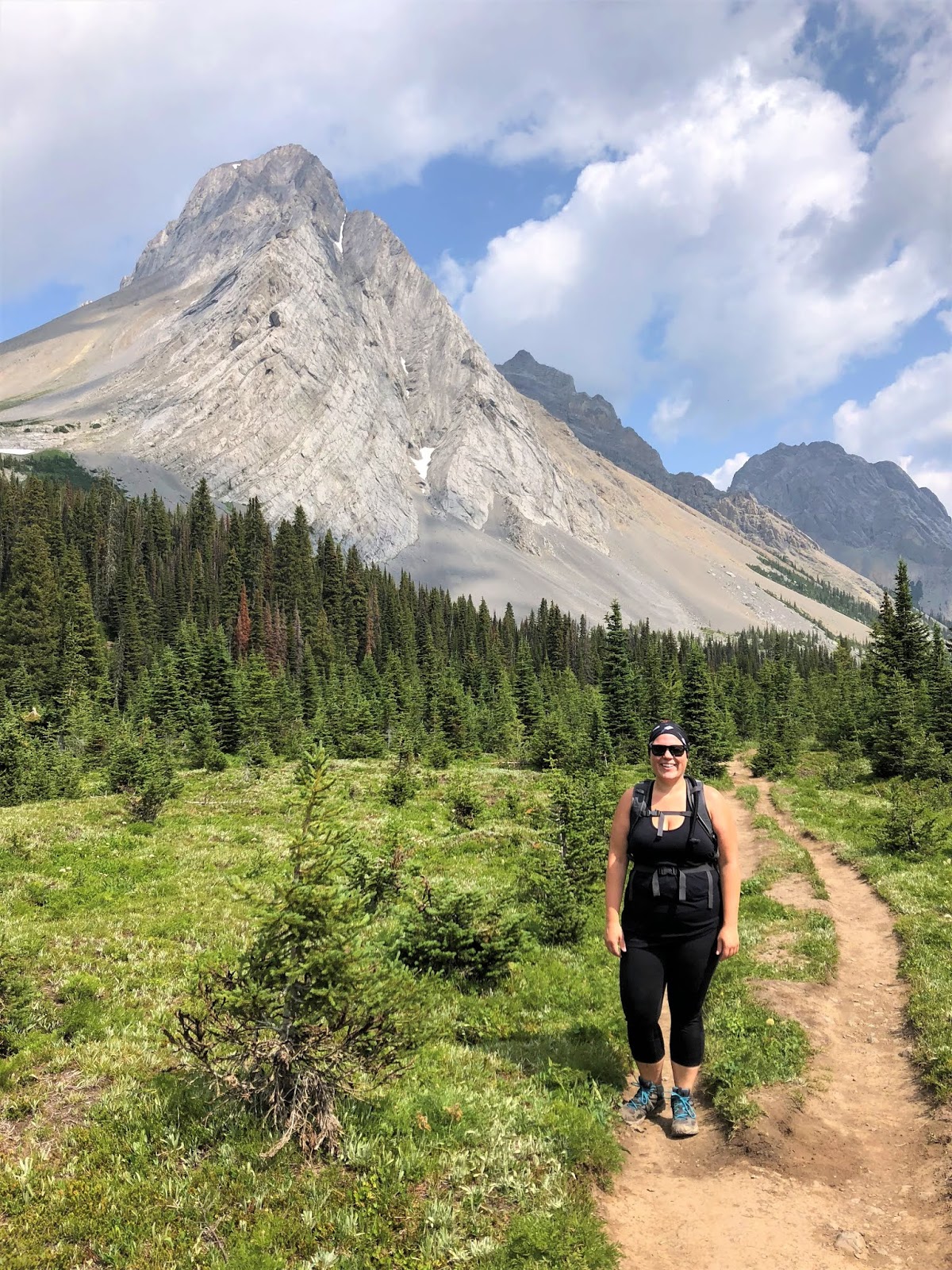
Chris and Rome on the trail
The trail begins at the south end of the parking lot and for the first 1.6km follows a wide, flat decommissioned logging road. The trekking is easy and the kids were happy to be walking beside us instead of stuck in the child-carriers for the entire day. You will need to keep a keen eye on your right-hand side for a small rock cairn and some blue flagging tape tied to an overturned tree. These mark the location for the turnoff that leads up to the lake. They're easy to miss, especially when engaged in lively conversation and enjoying a leisurely wilderness stroll.

Starting to get to the right elevation where the Larches grow
From the rock cairn the trail begins ascending up the lake. The rooty, rocky trail follows a trickling creek and provides views of Tent Ridge to our right. Over the next 1.4km we gain all of the 350 metres mentioned near the start of this post and none of the kids were walking by this point. Despite the chilly weather all of the adults were sweating while the kids relaxed comfortably in their carriers. Keeping them warm was more important now than before as they weren't trudging uphill, so they'd get colder much faster. There were solitary Larches scattered throughout the ascent, just hinting at the beauty to come.

The Fist peeking through the grove of Larches
As the trail leveled off we found ourselves only a few short steps from a clearing overlooking the picturesque lake and surrounded by so many golden Larches. The hard work was worth it with the small lake, which is quite shallow at this time of year, sitting below the commanding peak known as The Fist. We broke out some snacks and other than two other people we had the entire place to ourselves.

Tryst Lake sitting below The Fist and surrounded by Larch Trees
Chris and Coop enjoying a snack at the lake
The wind picked up quickly and Cooper was pretty cold, so we didn't stick around very long. I ended up wrapping him in my down jacket for the return hike to the truck. He must have been warm and comfy because he fell asleep on the way back down. Near the bottom we unexpectedly ran into Karen Ung and her amazing family. We're both Alberta Parks Ambassadors and have been following each other online for years now. It was great to finally meet her in person and hopefully we can link up sometime in the future for an adventure together. Please check out her website, Play Outside Guide, for all the best outdoor adventure tips, tricks, guides, and more.

Our crew sitting lakeside
Cooper all bundled up in dad's jacket for the trip back down
Despite the chilly weather I have no regrets about the day's experience. Sunshine and warms temps are always preferred, especially when hiking with little ones, but it did feel great to get out into the mountains. With the early snow this might have been our last hike of the season, but with snow comes winter sports like cross-country skiing and snowboarding, both of which make me very happy.

Monday, September 17, 2018

Etherington Creek Provincial Recreation Area

Trip Date: September 2018


In early September, despite the unseasonably chilly weather, we packed up the camper and headed southwest to the Highwood Region of Kananaskis Country for our last camping trip of the season. Good friends of ours joined us for the outing and neither family had stayed at Etherington Creek Campground before, so we were all looking forward to seeing someplace new. Due to a couple of unforeseen mishaps while trying to leave the city, we didn't roll in until well after sunset, which provided a new challenge for us; setting up the tent trailer in the dark. We manged to get things setup relatively quickly considering the darkness and had a roaring fire to help take a bit of the chill off. Our friends pulled in shortly after us and were also setup in no time.

Welcome to Etherington Creek Provincial Recreation Area. Someone added a little something of their own to this sign!
This campground has spacious campsites and some, like the photo above, are close enough to share with friends
Our campsite for the weekend
After a long week of work, sleep came quickly that first night. The next morning was quite chilly and I suspected that the weather played a role in how empty the campground was. We didn't exactly have the entire place to ourselves, but it sure felt that way. This PRA is also a staging area for snowmobilers in the winter time and for hunters in the autumn. I noticed two different pair of hunters hiking into the bush, shotguns in hand, searching for birds while I was out for my morning stroll with Cooper.

I was greeted by a moody sky Saturday morning
The fall colours had already started making an appearance
After a hearty breakfast and a leisurely morning hanging around the campsite we decided to get out and go for a short hike with the kids. We settled on Cat Creek Trail in Cat Creek Provincial Recreation Area, which was a short 15-minute drive north from the campground. Cat Creek Trail is an easy 2.6km return trail with a gorgeous little waterfall squeezing through a canyon at the end. 

Cat Creek Trailhead. You can tell the woodpeckers have been busy on this sign.
Chris and Coop enjoying a fantastic view
With views like this it's easy to see why this trail is so popular
The weather changed for the better as we continued along the trail. The clouds cleared out making way for the warm sunshine. We all had to get rid of our warm outer layers as it was way too hot. The entire area is rife with history. The trail passes the long-abandoned site of the Ford Mine and crosses the Lineham Company Road, which predates Highway 40 (Kananaskis Trail) and used to run between Longview and Kananaskis Country. All that remains of the Ford Mine is the footing of the bridge that used to link Ford Camp with its coal mine.

Cat Creek Falls
Cooper and I playing along Cat Creek
Hiking back to the parking lot
We couldn't believe our luck with the weather, so we spent some time exploring the day-use area, which provided some great views of the Highwood River and the peaks of the Continental Divide.

The Highwood River as viewed from the day-use area
A tree scarred from bear claw marks
After a delicious meal and some more campground relaxation we all headed out for a post-dinner stroll. Despite all their exercise already, the kids were ready for even more! 

Etherington Creek as it flows through the campground
Evening stroll with the family
We were greeted to a stunning sunset Saturday evening. Unfortunately this didn't last very long, but we enjoyed it none the less.
Sunday morning was again quite chilly, but that didn't stop Cooper, Rome, and I from getting out and having a long walk before breakfast. We walked throughout the campground and then explored Etherington Creek downstream from the PRA. It's a picturesque spot with small waterfalls and deep pools that would be extremely refreshing to swim in on a hot summer's day.

Etherington Creek
Crystal clear, clean, and cold!
I guess this is the 'Beer Bridge' that was mentioned in the first photo of this post!
Poor guy couldn't stay awake for our entire walk
Back in the campsite, ready to play!
The kids found this impressively large spider on a piece of firewood
On the drive back home Sunday afternoon I just had to stop and get a closer look at this abandoned caboose that rests in a field along Highway 541
Unfortunately I haven't been able to uncover any details or information about this little piece of history
We really had an awesome final weekend of camping and lucked out overall with the weather. We talked at length on this trip about all the camping adventures we hope to go on starting next spring. Stay tuned for all of our fall/winter escapes happening soon!

Monday, July 30, 2018

Burstall Pass

Trip Date: July 2018


Christine and I decided to have a kid-free hiking adventure on a late Friday in July. We chose Burstall Pass in Peter Lougheed Provincial Park as our destination for the day and we weren't disappointed in the least. The trail to the pass is 7.4km one-way with an elevation gain of 470m. The first 2.7km follow an old logging road and this section of trail is open to bikes, so we opted for a multi-sport day that included both biking and hiking.

Mud Lake
The trailhead for this hike is the Burstall Pass Day-Use Area along the Smith Dorrien/Spray Trail, directly across from the Chester Lake Trailhead, which happened to be closed due to bear activity. Christine quickly commented, "so the bears don't cross the road or what?" After leaving the parking lot the trail immediately passes Mud Lake, before entering the forest. Although not visible from the trail, we also passed Hogarth Lakes, a popular snowshoeing loop.

Biking along the old logging road
Even in the trees the views are still pretty good
As previously mentioned the first section follows an old logging road for 2.7km before reaching a concrete bike rack and sign indicating bicycles are not permitted past that point. We locked our bikes to the rack and hit the trail on foot. After passing the shallow Burstall Lakes we hit Willow Flats, which is the outflow from the Robertson Glacier. This section can be a bit confusing as the trail disappears into the vegetation as you cross several shallow creeks. There are signs indicating the correct route, but they can be tricky to spot as they aren't very close together. Basic route-finding skills are necessary here, but don't let it deter you from tackling this trail.

Shortly after leaving the bikes you're rewarded with this view of Commonwealth Peak
Entering Willow Flats. Make sure you're wearing waterproof shoes as this is the only bridge available and your feet might get wet depending on the water levels.
Whistling Rock Ridge as viewed from Willow Flats
Selfie with Commonwealth Peak
Robertson Glacier
Navigating Willow Flats with Snow Peak in the background
Once across Willow Flats the trail climbs steeply to an open meadow with magnificent views of Mount Birdwood, Snow Peak, and Whistling Rock Ridge. The meadow is relatively flat and is a nice reprieve from the ascent we just completed, but just as you catch your breath the trail, once again, resumes its climb towards Burstall Pass.

Entering the first meadow with Snow Peak above us
Christine posing with a very prominent Mount Birdwood
Panoramic shot of Mount Birdwood (left), Commonwealth Peak (centre), and the other side of Whistling Rock Ridge (right)
We were surprised at the number of wildflowers still in bloom
Mount Sir Douglas (far right) and Whistling Rock Ridge, which must be named for the abundance of marmots that we heard whistling throughout our hike. Those whistles really echo off the rock walls.
As you crest that final push to the pass you'll notice a small yellow sign welcoming you to Banff National Park. You might think this is odd, but Burstall Pass actually butts up against the eastern border of the famous national park. The trail continues on into the park before reaching Leman Lake (4.9km), Palliser Pass (10.9km), and eventually the junction with Bryant Creek (18.0km). As Burstall Pass was our goal for the day we opted to stop for lunch while enjoying the spectacular view that spread out in front of us.

The final push to Burstall Pass
Welcome to Banff National Park
My girls enjoying the view and their respective lunches
Looking west into Banff National Park. I believe the mountains have the following names, from left to right Leval, Vavsour, Warre, and Currie and way in the background (far right) with a bit of snow on the summit is the Matterhorn of the Rockies, Mount Assiniboine.
A quick selfie from Burstall Pass
We didn't stick around too long as there was rain in the forecast. The wind was starting to pick up and with it came much darker clouds. After snapping a few photos we packed up and began our descent. We were really hoping to beat the weather or at least get as low as possible before the skies opened up.

Back in Peter Lougheed Provincial Park after enjoying our lunch in Banff
One last look at Mount Birdwood as the wet weather makes its way towards us
Starting our descent
Christine and Rome making their way back down
I'm happy to report that it rained just enough for us to say it rained, but we did experience some intense thunder. Much like the marmot's whistles I am assuming the booming thunder echoes off the mountains making it seem much louder and more extreme than it really is. We were safely back in the truck and pulling out of the parking lot when the rain really started to fall.

After completing this trek for the first time it's easy to see why it's considered a classic hike in Kananaskis. We both thoroughly enjoyed the varied terrain and incredible scenery. Christine even mentioned that it's easily in her top three hikes of all time now. We both said it would be a great option in autumn as the larches are turning from green to their famous golden colour, so we might see you there in the fall!