Showing posts with label Glacier. Show all posts

Monday, July 30, 2018

Burstall Pass

Trip Date: July 2018


Christine and I decided to have a kid-free hiking adventure on a late Friday in July. We chose Burstall Pass in Peter Lougheed Provincial Park as our destination for the day and we weren't disappointed in the least. The trail to the pass is 7.4km one-way with an elevation gain of 470m. The first 2.7km follow an old logging road and this section of trail is open to bikes, so we opted for a multi-sport day that included both biking and hiking.

Mud Lake
The trailhead for this hike is the Burstall Pass Day-Use Area along the Smith Dorrien/Spray Trail, directly across from the Chester Lake Trailhead, which happened to be closed due to bear activity. Christine quickly commented, "so the bears don't cross the road or what?" After leaving the parking lot the trail immediately passes Mud Lake, before entering the forest. Although not visible from the trail, we also passed Hogarth Lakes, a popular snowshoeing loop.

Biking along the old logging road
Even in the trees the views are still pretty good
As previously mentioned the first section follows an old logging road for 2.7km before reaching a concrete bike rack and sign indicating bicycles are not permitted past that point. We locked our bikes to the rack and hit the trail on foot. After passing the shallow Burstall Lakes we hit Willow Flats, which is the outflow from the Robertson Glacier. This section can be a bit confusing as the trail disappears into the vegetation as you cross several shallow creeks. There are signs indicating the correct route, but they can be tricky to spot as they aren't very close together. Basic route-finding skills are necessary here, but don't let it deter you from tackling this trail.

Shortly after leaving the bikes you're rewarded with this view of Commonwealth Peak
Entering Willow Flats. Make sure you're wearing waterproof shoes as this is the only bridge available and your feet might get wet depending on the water levels.
Whistling Rock Ridge as viewed from Willow Flats
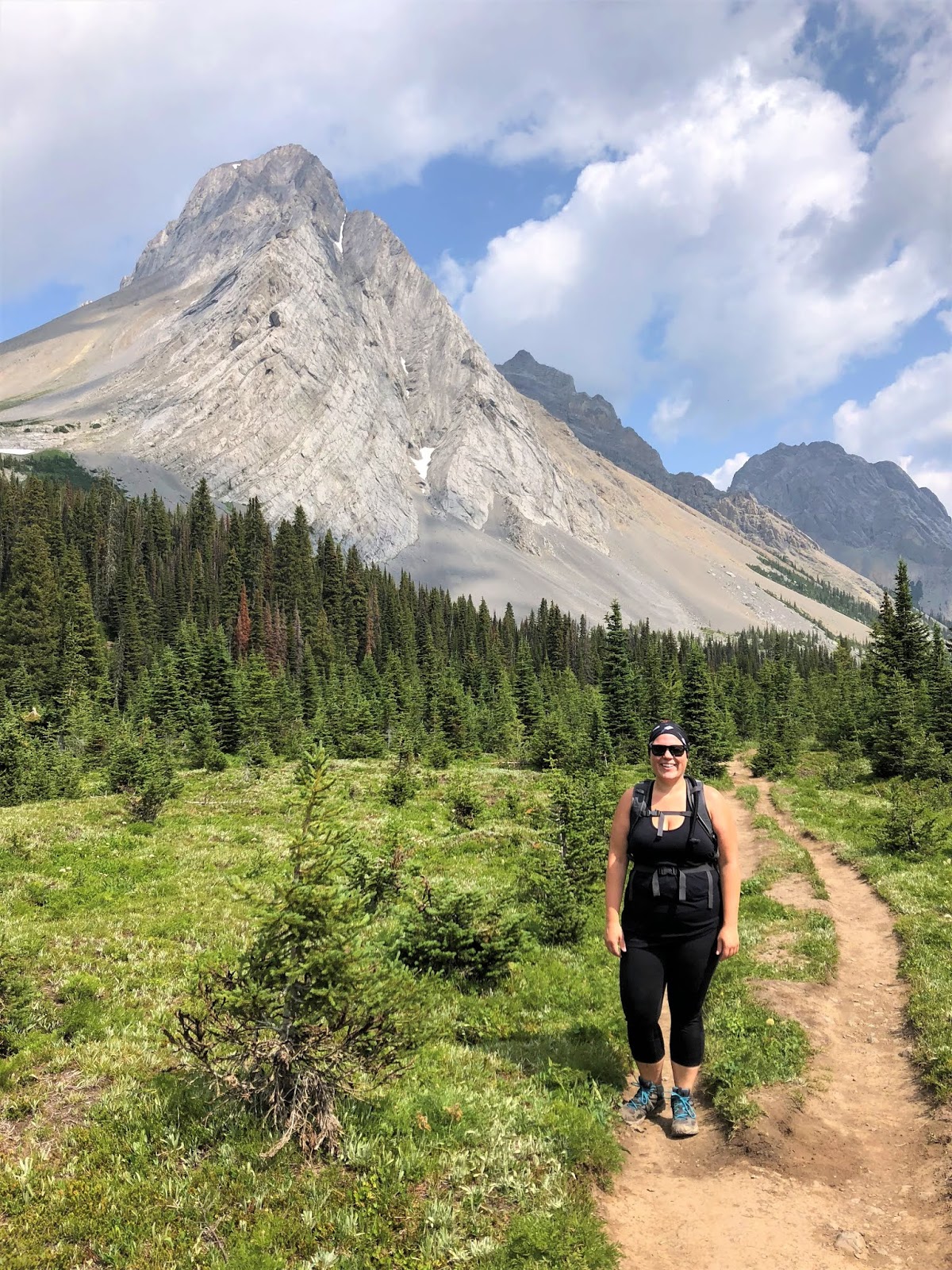
Selfie with Commonwealth Peak
Robertson Glacier
Navigating Willow Flats with Snow Peak in the background
Once across Willow Flats the trail climbs steeply to an open meadow with magnificent views of Mount Birdwood, Snow Peak, and Whistling Rock Ridge. The meadow is relatively flat and is a nice reprieve from the ascent we just completed, but just as you catch your breath the trail, once again, resumes its climb towards Burstall Pass.

Entering the first meadow with Snow Peak above us
Christine posing with a very prominent Mount Birdwood
Panoramic shot of Mount Birdwood (left), Commonwealth Peak (centre), and the other side of Whistling Rock Ridge (right)
We were surprised at the number of wildflowers still in bloom
Mount Sir Douglas (far right) and Whistling Rock Ridge, which must be named for the abundance of marmots that we heard whistling throughout our hike. Those whistles really echo off the rock walls.
As you crest that final push to the pass you'll notice a small yellow sign welcoming you to Banff National Park. You might think this is odd, but Burstall Pass actually butts up against the eastern border of the famous national park. The trail continues on into the park before reaching Leman Lake (4.9km), Palliser Pass (10.9km), and eventually the junction with Bryant Creek (18.0km). As Burstall Pass was our goal for the day we opted to stop for lunch while enjoying the spectacular view that spread out in front of us.

The final push to Burstall Pass
Welcome to Banff National Park
My girls enjoying the view and their respective lunches
Looking west into Banff National Park. I believe the mountains have the following names, from left to right Leval, Vavsour, Warre, and Currie and way in the background (far right) with a bit of snow on the summit is the Matterhorn of the Rockies, Mount Assiniboine.
A quick selfie from Burstall Pass
We didn't stick around too long as there was rain in the forecast. The wind was starting to pick up and with it came much darker clouds. After snapping a few photos we packed up and began our descent. We were really hoping to beat the weather or at least get as low as possible before the skies opened up.

Back in Peter Lougheed Provincial Park after enjoying our lunch in Banff
One last look at Mount Birdwood as the wet weather makes its way towards us
Starting our descent
Christine and Rome making their way back down
I'm happy to report that it rained just enough for us to say it rained, but we did experience some intense thunder. Much like the marmot's whistles I am assuming the booming thunder echoes off the mountains making it seem much louder and more extreme than it really is. We were safely back in the truck and pulling out of the parking lot when the rain really started to fall.

After completing this trek for the first time it's easy to see why it's considered a classic hike in Kananaskis. We both thoroughly enjoyed the varied terrain and incredible scenery. Christine even mentioned that it's easily in her top three hikes of all time now. We both said it would be a great option in autumn as the larches are turning from green to their famous golden colour, so we might see you there in the fall!

Wednesday, August 30, 2017

Glacier Adventure & Glacier Skywalk

Trip Date: August 2017


To continue my reporting on Brewster's Ultimate Explorer Pass I present my recap of the Glacier Adventure and Glacier Skywalk tours. My first story was about the Minnewanka Lake Cruise and like that article this one can also be found on the Calgary Guardian website.

Welcome To The Icefield Centre in Jasper National Park
“The view that lay before us in the evening light was one that does not often fall to the lot of modern mountaineers. A new world was spread at our feet: to the westward stretched a vast ice-field probably never before seen by the human eye, and surrounded by entirely unknown, unnamed and unclimbed peaks.”
~J. Norman Collie - First European (with Herman Wooley) to discover the Columbia Icefield in 1898
The Icefield Discovery Centre with Nigel Peak in the background
Set foot on ancient glacial ice in the Canadian Rockies and check glacier exploration off your bucket list. The Columbia Icefield is nestled at the heart of the Icefields Parkway and straddles the border between Banff and Jasper National Parks. It is the largest icefield south of the Arctic Circle, encompassing some 325-square-kilometres. One of its main tongues, the Athabasca Glacier, is estimated to be 13,000 years old and holds the distinction of being the most visited glacier in all of North America due to its proximity to the highway. Glaciers are inherently dangerous places. Specialized training, technical mountaineering skills, and proper gear are all essential for safely traversing their icy surfaces. Thankfully with the help of Brewster Travel Canada you can now explore the Athabasca Glacier without the need for lengthy training sessions or expensive gear.

The Athabasca Glacier as viewed from the Icefield Discovery Centre
A panoramic shot from the Icefield Centre
This is the Ice Explorer that transported us to and from the glacier
Glaciers are the prolonged accumulation of snow that, over a number of years, is compressed into solid ice. In the case of the Columbia Icefield its depth ranges from 100 to 365 metres, making it exceptionally thick. Glaciers are unique in that they're constantly moving, but at a very slow rate. Think of the Columbia Icefield as a large frozen lake and its glaciers (it feeds eight major ones) are like large slow-moving rivers of ice. The rocky debris that you see surrounding glaciers are called moraines. Terminal moraines are located at the foot of the glacier and indicate its maximum advancement while lateral moraines accumulate along its edges.

Exploring the Athabasca Glacier within the designated area
Up close and personal with the glacier's ancient ice
Glacier Selfie!
Athabasca Glacier panoramic shot
I filled my water bottle with glacier melt-water
High up on the glacier with the Icefield Centre way in the background
To access the glacier reserve your seat on one of Brewster's massive Ice Explorers. These highly-specialized vehicles are designed for all-terrain travel, making them the perfect option for transporting visitors onto the surface of the glacier. Each Ice Explorer costs $1.3-million-dollars and there are only 23 in operation around the globe; 22 of which are used at the Columbia Icefield (the 23rd is at a research station in Antarctica). With a top speed of 18 kilometres-per-hour your pace will be glacial at best, but that gives you plenty of time to absorb the rugged mountain landscape that surrounds you. Upon your arrival you'll be given approximately 30 minutes to explore the glacier within the designated area. Please don't venture beyond the barriers as hidden dangers, such as crevasses, are present and falling into one could prove deadly. The surface of the glacier can be upwards of 15 degrees-Celcius cooler than the Icefield Discovery Centre so be prepared for chilly temperatures and inclement weather even during the warmest months. Don't forget an empty water bottle so you can fill it with glacial melt-water; it doesn't get much fresher than that! Bringing the entire experience together were the guides. They proved to be a wealth of information and were eager to share facts and stats about glaciers and the powerful impact they have on the surrounding environment.

The Glacier Skywalk 
The Discovery Trail runs along the top of the cliff with the Sunwapta Valley below
After departing the glacier you will leave terra firma and walk where eagles soar along the Glacier Skywalk. Brewster's newest attraction (it was built in spring 2014) is a glass-bottomed observation deck overlooking the magnificent Sunwapta Valley. The Skywalk is perched on the edge of a 280-metre cliff so your first steps into the abyss may be timid, but that feeling will soon pass as the breathtaking scenery unfolds before you. If the Skywalk is the grand finale, the lead-up is just as impressive. A one-kilometre self-guided interpretive walk along the Discovery Trail where you will observe fossils, wildlife, waterfalls, and more sets the tone for the entire experience. Here you are not limited by the hands of the clock, so take your time and immerse yourself in the beauty of the natural world that is all around you.

A panoramic shot of the Glacier Skywalk
Due to climate change the Athabasca Glacier is receding at an alarming pace, having lost half its volume over the past 125 years. Don't wait too long to visit as I fear its days as a tourist attraction are numbered. By venturing onto the Glacier Skywalk you'll have joined just a handful of people on the planet to have experienced this attraction. Since it was built only three years ago the number of people to peer through the glass floor is still quite minimal. If you're looking for a new adventure or just want to deepen your connection with the Rocky Mountains look no further than the Columbia Icefield and its captivating attractions. Keep in mind you can pair the Glacier Adventure with the Glacier Skywalk for a day filled with unforgettable experiences and memories to last a lifetime.

Wrapping-up a fantastic day in Jasper National Park
To learn more about the Glacier Adventure or any of the other Rockies Attractions please visit the Brewster Travel Canada website or you can purchase the Ultimate Explorer Pass that provides admission to four of Brewster's top attractions. You can also connect with Brewster on social media (Facebook, Twitter, Instagram, YouTube, Pinterest, and Vimeo) and don't forget to share all your Glacier Adventure photos using the hashtag #GlacierAdventure and/or #GlacierSkywalk.

Wednesday, July 24, 2013

Illecillewaet Campground & Trails

Trip Date: August 2007


Every year on our way to and from the Shuswap we have to drive through Roger's Pass and Glacier National Park.  It is a beautiful part of the country and I've always wanted to go camping there.  In late August of 2007, Christine and I decided to head out and do just that!  We decided to set up our tent in the Illecillewaet Campground, which is about 345km west of Calgary along the Trans-Canada Highway in Glacier National Park.  It is a beautiful campground and I would highly recommend it to anyone wishing to camp in the area.

Our camp site in Illecillewaet Campground
While we were there we also got out and enjoyed a short interpretive trail at the neighboring campground; Loop Brook Campground.  The Loop Brook Interpretive Trail is only about 1.8km in length, but it takes you through a section of the old railway that once looped through Roger's Pass.  It showcases the stone trestle pillars that once carried the railway high above the valley.  Between the valley bottom and the summit of Roger's Pass, the original Canadian Pacific Railway (CPR) line made many continuous loops to soften the grade and avoid the worst avalanche slopes.  The total curvature of these loops actually equaled seven complete circles.  The stone pillars are among the oldest surviving man-made structures in western Canada.  

Christine reading about a collapsed stone pillar
Loop Brook Interpretive Trail
Chris with Mt. Bonney in the background
CPR stone trestle pillars
The remains of a collapsed snow shed
Stone trestle pillars
Stone pillars
Christine and I