Trip Date: June 2008

This trip was part of a staff retreat/training I did with Base Camp.
We started off by stopping at Head-Smashed-In Buffalo Jump, which is
about 185km south of Calgary on secondary Highway 785. Head-Smashed-In
Buffalo Jump was designated a world heritage site by the United Nations Educational Scientific and Cultural Organization (UNESCO) in 1981. The
jump was used for nearly 6,000 years by the Plains People as a hunting
practice. They would drive stampeding bison over the 10m cliff to their
death. In order to get the buffalo to go where they wanted, young men
trained in animal behaviour called "Buffalo Runners" would mimic the
calls of a lost bison calf. Once the animals moved closer the hunters
would circle around behind the animals and scare them by shouting or waving
items in the air. The bison were forced into the drive lanes, which were
man-made piles of stone. The bison at the front would try and stop, but
the sheer weight of the herd behind them ultimately pushed the animals over the
edge of the cliff. The hunters would then butcher the dead bison and dry
the meat in the nearby campsite and processing area. Legend has it that a
young Blackfoot boy wanted to watch the bison plunge to their death from below
the cliffs. Standing below a ledge for
shelter he witnessed the bison fall past him, but the hunt was unusually good
that day, and as the bodies piled up he became trapped between the cliff and
the dead bison. When the hunters came to
butcher the animals they found the boy with his skull crushed from the weight
of the animals. From then on they
referred to the place as "Head-Smashed-In".
 |
| A map showing the drive lanes, the jump site, and the processing area |
 |
| Head-Smashed-In Buffalo Jump |
 |
| Tipis set-up below the cliff |
 |
| Yellow-Bellied Marmot |
After touring the jump site and interpretive centre it was time to make our way to Milk River. We would be spending the night in the town of Milk River before putting our canoes in the river the next day. The trip is approximately 70km between Milk River and Writing-on-Stone Provincial Park with a one-night stay at Poverty Rock. We would also be camping for one night in Writing-on-Stone Provincial Park at the end of the canoe trip. The town of Milk River is about 300km southwest of Calgary along Highway 4 and is just north of the Montana border.
 |
| Cliff Swallows nesting on a bridge over the Milk River at our put-in spot |
 |
| Me and Eric in our canoe |
 |
| Long-Eared Owls nesting in the cliffs above the Milk River |
 |
| Ferruginous Hawk sitting on its massive nest above the Milk River |
 |
| Standing on top of Poverty Rock |
 |
| Looking down on our campsite from the top of Poverty Rock |
 |
| The Milk River |
 |
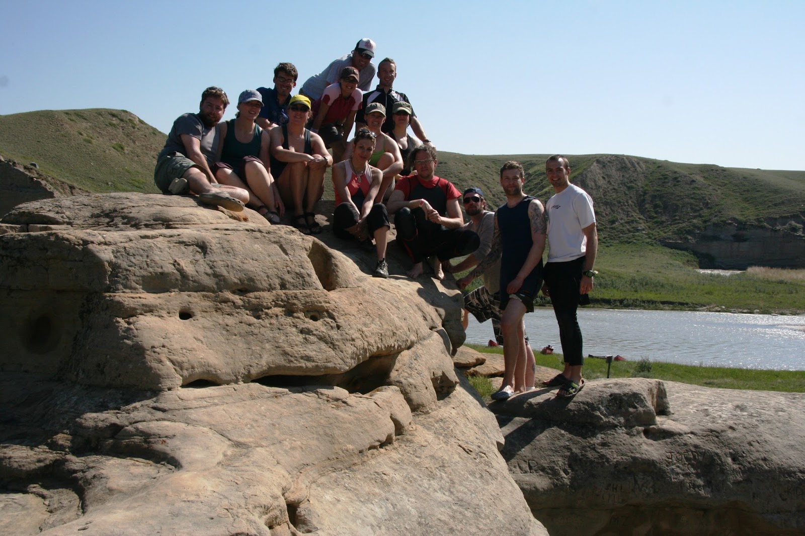
| A team picture on Poverty Rock before hitting the water the next morning |
 |
| I'll try out the stern of the canoe today! |
Writing-on-Stone Provincial Park, set in the prairie grasslands of southern Alberta, serves as both a nature preserve and protection for a large number of First Nation petroglyphs (rock carvings) and pictographs (rock paintings). In fact, the Milk River valley contains the largest concentration of rock art on the great plains of North America. The park is also filled with a variety of interesting rock formations and hoodoos, so we were never left without something to explore! The park has been nominated by Parks Canada and the Government of Canada for World Heritage Site status with UNESCO. In the application the name of the park was filed under Áísínai’pi, which is Blackfoot for "it is pictured/written". There is archaeological evidence that the valley was inhabited by First Nation people as far back as 9,000 years ago.
 |
| The Milk River with Montana's Sweet Grass Hills in the background |
 |
| Nuttall's Cottontail |
 |
| Staff picture on top of some hoodoos |
 |
| Sitting in Writing-on-Stone Provincial Park |
 |
| Lots of hoodoos |
 |
| They seem to go on forever |
 |
| Close-up photo of some hoodoos |
 |
| Relaxing inside one of the hoodoos |
 |
| This is an old RCMP post that was originally built in 1887 to fight cross-border whiskey smuggling. The original post burnt down, but was rebuilt between 1973 and 1975. |
 |
| Some of the petroglyphs that can be found in the park |
 |
| This one appears to be a battle scene complete with guns and bullets |
 |
| Close-up of the petroglyphs |


I am writing in order to obtain permission to use your image (with proper credit given of course) of the Sweetgrass Hills in a local-regional publication on Montana’s natural history. We specialize in small print runs of locale specific history titles and would love your image to accompany the chapter on island ranges.
ReplyDeleteI appreciate your consideration.
Gratefully,
Artie Crisp
Commissioning Editor l The History Press
ph: +1 843.577.5971 x239 and fax: +1 843.577.6712
www.historypress.net I www.arcadiapublishing.com
Hi Artie, I just sent an email to publishing@historypress.net regarding your request. I apologize for the extremely delayed response, but I must have completely missed this comment somehow, so for that I am sorry. Hopefully you receive my email, but if not let me know and we can sort this out. Thanks for your interest in my photo, much appreciated.
Delete